Learn More About the Projects Currently Underway
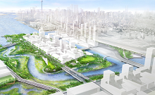
DON MOUTH NATURALIZATION PROJECT
The Don Mouth Naturalization and Port Lands Flood Protection and Enabling Infrastructure Initiative (PLFPEI) is one of the largest infrastructure projects in Toronto’s history.
Located in Toronto’s Port Lands, this $1.25-billion initiative will reconnect the Don River to Lake Ontario by creating more than 1000 metres of new river channel and a naturalized river mouth.
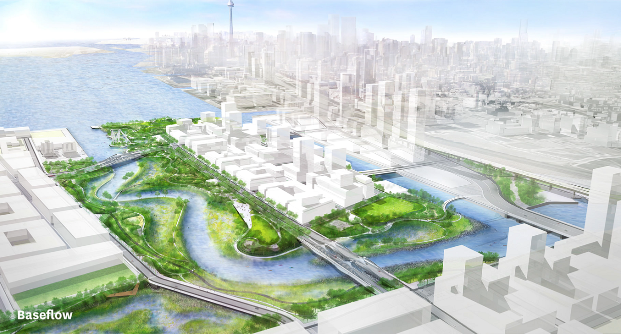
The naturalized river valley will add 16 hectares of new parkland, promenades, and riverfront open space to the eastern waterfront, as well as 14 hectares of new aquatic habitat and wetlands to improve biodiversity and water quality, and attenuate flooding and erosion.
The project is expected to be completed in 2024.
Background: History of the Eastern Waterfront
The Port Lands were created in the early 20th century through the infilling of Toronto’s Ashbridges Bay Marsh — a 428-hectare coastal marsh that once characterized the Toronto waterfront east of the Don River.
At the time, the mouth of the Don River was also straightened to form what is now Keating Channel.
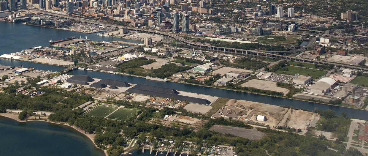 Aerial view of the Port Lands today.
Industrial activities — ranging from sawmills to cattle processing to petroleum storage — began to move in along the Don River’s banks, and significantly altered the river’s form and function.
The industrialization of the Don and the loss of this coastal marsh contributed to the designation of Toronto and Region as an Area of Concern (AOC). It resulted in increased flooding, loss of aquatic habitat, and reduced fish and wildlife diversity and abundance.
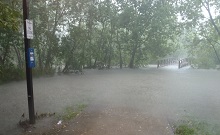
WET WEATHER FLOW MASTER PLAN
Adopted in 2003, the City of Toronto’s Wet Weather Flow Master Plan (WWFMP) is a 25-year stormwater management plan intended to protect Toronto’s waterways and environment from the impacts of wet weather flow.
Historically, the adverse effects of wet weather flow have included impaired water quality at beaches, degraded ecosystem health of watersheds, erosion of stream banks and damaged sewer infrastructure, and flooding during extreme storm events.
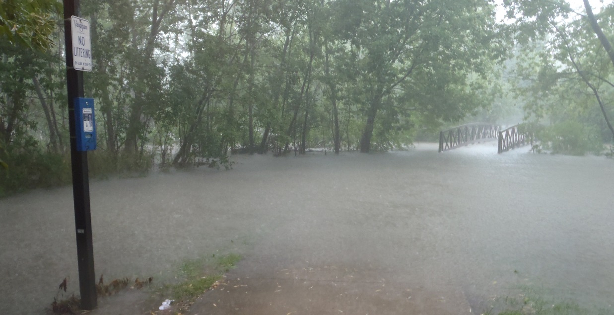 Heavy rainfall in August 2018 led to flooding in areas across the GTA.
Through implementation of the WWFMP, the City of Toronto is taking steps to:
- Improve water quality at the city’s beaches, streams, and rivers
- Protect city assets
- Reduce the risk of flooding on private and public property
The WWFMP lays out 13 objectives, meant to address four main concerns:
- Water quality in local waterways
- Water quantity
- Natural areas and wildlife
- Sewer systems
The implementation of the City of Toronto’s WWFMP is identified in the Toronto and Region RAP work plan as an action that will advance re-designation of the beach closures (BUI 10) and eutrophication or undesirable algae (BUI 8) impairments.
DON RIVER AND CENTRAL WATERFRONT COMBINED SEWER OVERFLOW (CSO) PROJECT
A key component of the City of Toronto’s Wet Weather Flow Master Plan (WWFMP) is the implementation of the Don River and Central Waterfront CSO project: Canada’s largest combined sewer overflow project.
Approved by City Council in 2011, the project will improve water quality in the Lower Don River, Taylor-Massey Creek, and Toronto’s inner harbour via an integrated wet weather flow management system that captures, stores, and transports discharges from all combined sewer outfalls that feed into these waterways.
The preliminary design was completed in 2015 and construction of the first phase, the Lower Don Tunnel/Coxwell Bypass, began in 2018. Construction will take place over a period of 25 years, with a completion target of 2038.
The current cost for the Don and Central Waterfront CSO project is over $3 billion. Completion as early 2030 may be possible (per a June 2019 City of Toronto staff report) with an additional $1.07 billion in external funding.
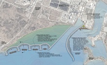
ASHBRIDGES BAY LANDFORM PROJECT
The Ashbridges Bay Landform project is an integral component of the Don and Central Waterfront CSO project.
The landform will be the site of a new high rate treatment plant where combined sewer overflow (CSO) treatment will occur.
The benefits of the project include:
- Erosion control and shoreline protection
- More land for water treatment to take place
- Reduced need for dredging of the Coatsworth Cut navigation channel
- Enhanced fish habitat along the shoreline and in a newly created embayment
Construction of the roughly 27-hectare landform began in 2019 and is expected to be completed by 2024.
Select image to view full-sized.
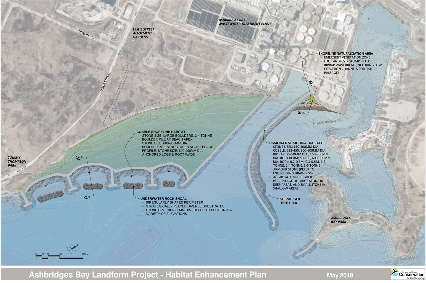
As part of the Don and Central Waterfront CSO project, the Ashbridges Bay initiative will help us advance re-designation of the beach closures (BUI 10). The addition of aquatic habitat will also help us address loss of fish and wildlife populations (BUI 3) and loss of fish and wildlife habitat (BUI 14).
The aquatic habitat components of the project include:
- Four submerged rock shoals within the headland-beach system
- Submerged rock piles, anchored log tangles, and tree wads in the cobble beaches
- A shoreline naturalization area near the opening of Coatsworth Cut
- Gravel fill along the inner bend of the central breakwater
- A vertical sunken tree field at the inner bend of the central breakwater
- Submerged rock berms along the eastern breakwater
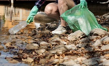
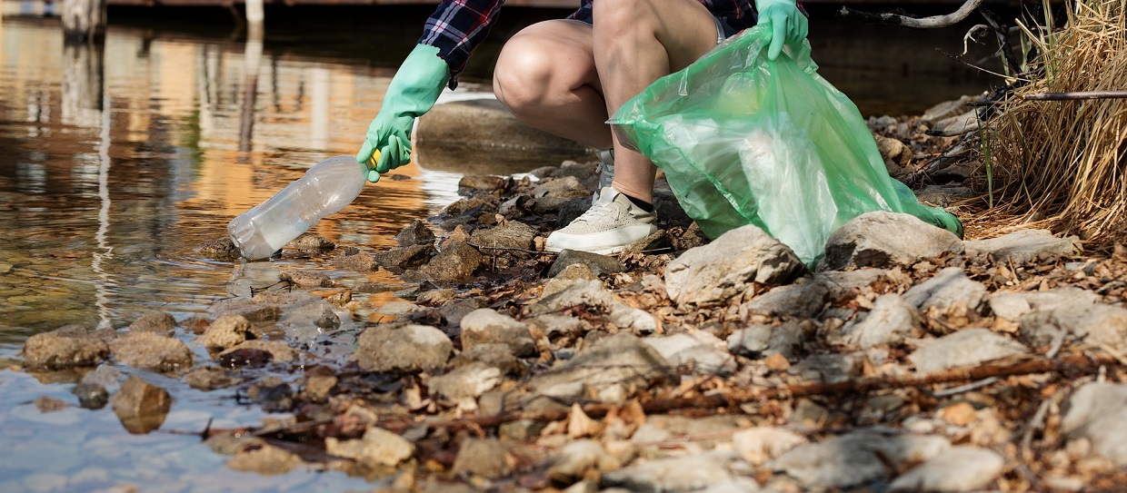
FLOATABLES STRATEGY
While Toronto’s waterfront is much cleaner today than it was in 1987, this improvement isn’t always clearly visible to the public — in part because of the presence of plastics and other floating litter, known collectively as “floatables”.
In 2017, Environment and Climate Change Canada’s Great Lakes Protection Initiative funded a Toronto and Region Conservation Authority (TRCA) project to develop a “floatables strategy” that would identify priorities and actions for addressing floating garbage.
TRCA, the City of Toronto, Ports Toronto, and Harbourfront Centre, in consultation with the University of Toronto and Swim Drink Fish, are currently in the process of reviewing the draft Floatables Strategy.
This draft strategy identifies opportunities for the development of policy, removal of floatables, ongoing monitoring of floating debris and garbage, and the creation of new partnerships.
Once the review is completed, the Floatables Strategy will be maintained as a living document, with the possibility of engaging new stakeholders in adopting the program to areas of the Lake Ontario waterfront beyond the Toronto Harbour.
SEABINS
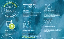
Ports Toronto is spearheading the installation of floating trash bins called “seabins” along the Toronto waterfront.
Designed to eliminate single-use plastics, microplastics, and other harmful materials from our waterways, seabins can gather pieces of debris as small as 2 millimetres that pass within their vicinity.
The project began with the successful pilot installation of seabins at the Outer Harbour Marina in 2019. The program has since expanded to include Toronto’s inner harbor.
Ports Toronto has also partnered with the University of Toronto Trash Team to develop a research and education application for the seabin program.
The U of T Trash Team will collect and analyze the contents of the Seabins, and will use the results to determine where materials originated. This knowledge, in turn, will inform education programs aimed at preventing plastics, microplastics and other litter from reaching our waterways.
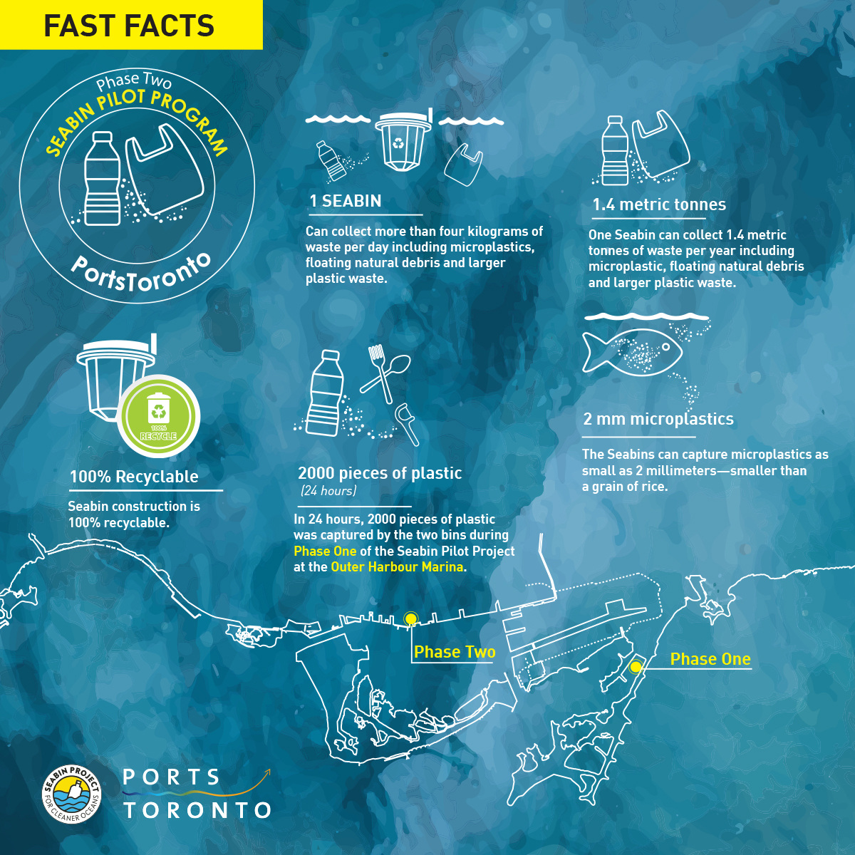 Illustration: Ports Toronto.